In Italy, the Trento province’s emergency preparedness organization has obtained a grant for the improvement of its helicopter operations through the creation of a satellite-guided route to a hospital, which is hoped to reduce the proportion of aborted missions. Speaking at the European Aviation Safety Agency’s (EASA’s) 10th rotorcraft symposium, pilot Arrigo Avi shared his team’s experience.
The operator is required to have two helicopters available during the day and one at night. This is sometimes challenging, Avi said. Weather in the alpine valleys of Northern Italy is often bad. Moreover, the only navigation aid is a VOR-DME in Trento airport, with limitations in sectors and altitude.
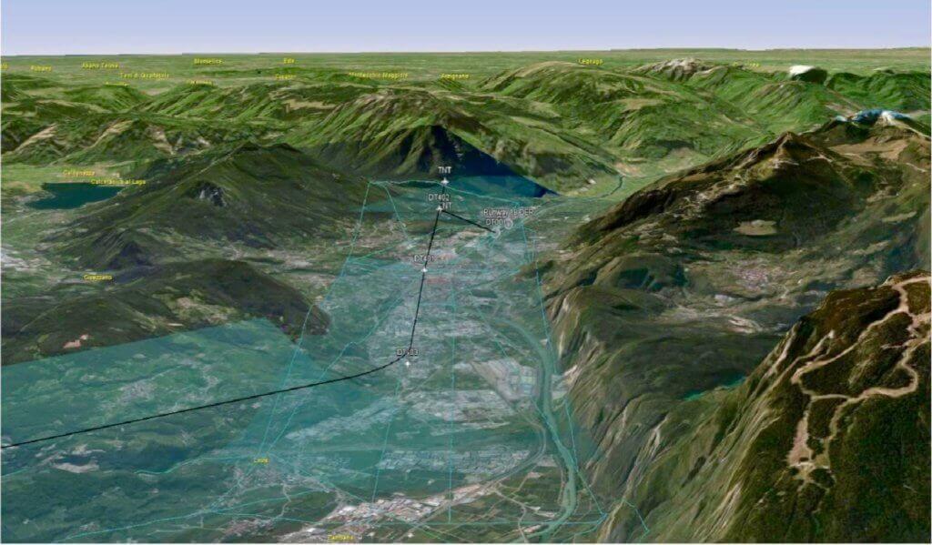
The airport’s management company is now developing a route that makes the most of EGNOS, Europe’s satellite-based GPS augmentation system. It will serve Trento airport and a helipad at the nearby Cles hospital. A specific point-to-point route will connect the two. A “safe, H24 helicopter connection” to the hospital is expected by July 2017, Avi said.
GSA, the European global navigation satellite system agency, has agreed to contribute almost half of the €660,000 (US$700,000) cost of the project. Most of the expense is for the planned January 2017 upgrade of the two Leonardo AW139 medium twins the operator flies. The Primus Epic Phase 7 cockpit upgrade will bring the capability to perform RNP (required navigation precision) approaches with a precision of 0.3 nautical miles.
Despite having to navigate through some challenging bureaucracy, Avi and his team managed to achieve their targets in time. “The European funding mechanism is well known but not so easy to understand,” he said. The route is hoped to be the first in a series, and night vision goggle capability should be integrated in the second half of 2017.
Since 2014, Avi’s helicopter organization has been flying more missions and hours, with an average 10 percent increase annually. It projects to log more than 2,500 missions this year.