

Helicopter operations run out of major terminals typically have access to the latest current weather observations. Such reports are essential for safe takeoffs and landings for both fixed-and rotary-wing aircraft. However, for smaller airports and heliports, the availability of current weather observations can vary considerably.
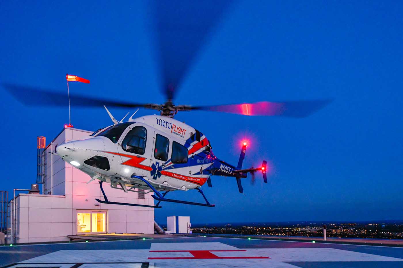
Wind speed and wind direction are critical elements at the touchdown and liftoff area (TLOF) for safe helicopter operations. Fortunately, the venerable windsock or wind cone can provide this information at low cost. It is the minimal instrumentation required for a heliport. The wind cone itself is simple and the concept has been around for centuries. A truncated cone made of fabric, open at both ends, is the indicator, with the large end of the cone affixed to a ring to keep it open. The apparatus sits on a pivot and can swivel into the wind, thus filling the cone with air and extending it. Pilots can then get a visible indication of the wind’s direction and strength.
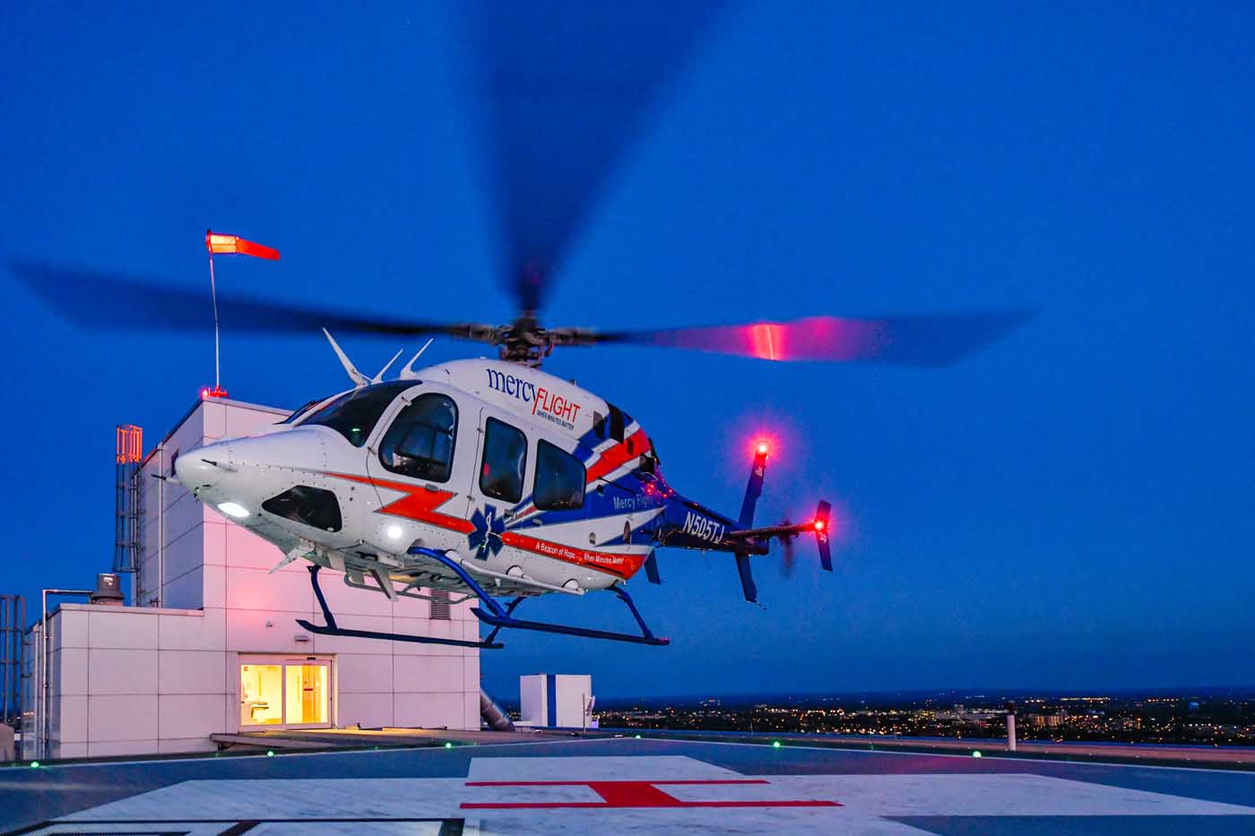
There are set criteria for the design of these devices, as well as their location. They must be easily visible, and are typically eight or 12 feet in length and of a color that provides the best contrast with the background — either white, orange, yellow, or a combination of two colors. For heliports with night operations, the wind cone should be illuminated, either internally or externally.
The wind cone should be able to rotate to indicate the wind direction for a minimum wind speed of three knots. A fully extended wind sock should correspond to a minimum wind speed of 15 knots. Some wind cones are striped, with the stripes corresponding to the wind speed. A sock extended to the first stripe indicates a speed of three knots, the second stripe six knots, and so on. The wind cone must be able to withstand wind speeds of 75 knots.

In terms of placement, the wind cone must be in an open area away from any obstacle that may affect the wind. It must be clearly visible for some distance (the Federal Aviation Administration recommends 500 feet/150 meters, Transport Canada 650 feet/200 meters). This allows it to be seen by pilots coming in for a landing, as well as those taking off from the TLOF. And, of course, it can’t be too close to the TLOF to be a hazard. In some situations, more than one wind cone may be needed to provide wind information under all conditions.
Automating weather observations
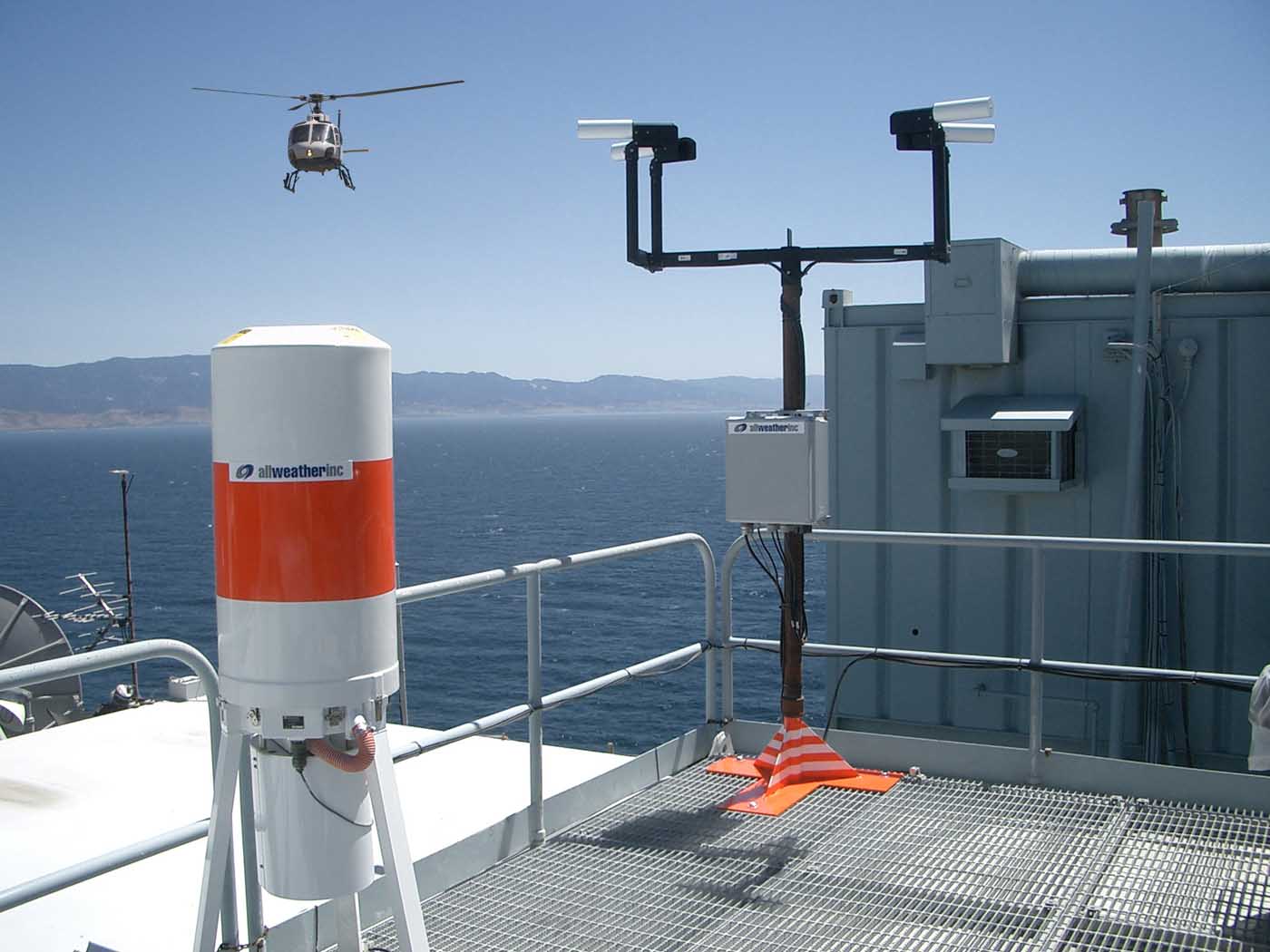
If it is deemed necessary and financially feasible, heliports (or smaller airports) may be equipped with automated weather observing instruments. There are a number of companies that can provide such equipment, typically packaged in a fully automated weather station. There are many acronyms used to describe them, including ASOS (automated surface observing station), AWOS (automated weather observing system), SAWS (standalone weather system), SWS (surface weather system), LWIS (limited weather information system), and AWSS (automatic weather sensor system).
In terms of the terminology used, the ASOS in the U.S. is the equivalent of the AWOS in Canada. They have a variety of sensors and report all of the standard elements. Confusingly, the AWOS in the U.S. is the equivalent of the Canadian LWIS, usually inferring a more limited number of sensors. LWIS provides hourly reports on wind, temperature, dew point, and altimeter setting. AWOSs range from AWOS A (with just altimeter settings) to AWOS IV (a fully equipped ASOS-type station).
The number of weather elements observed depends on the configuration of the system being used, which is generally reflected in the initial cost. These elements include wind speed and direction (and possibly gusts); visibility; precipitation identification; cloud height; temperature and dew point; pressure or altimeter setting; derived density altitude; and precipitation accumulation. A more specialized sensor can detect freezing precipitation, too. Lightning occurrence can be detected using local sensors, or by having your system tied into a larger lightning detection network. Heating elements for some sensors are also available for winter use.
To obtain accurate readings, there are set criteria for siting weather sensors. Initially, these guidelines are set by meteorological organizations using basic knowledge of the elements being measured. Added and modified criteria are often required when these sensors are being used at airports. Governing agencies such as the Federal Aviation Administration, Transport Canada, and the U.K.’s Civil Aviation Authority have set guidelines that must be followed.
There are specific siting criteria for the instruments to ensure correct readings, and these are generally available online. Such guidelines, however, must often be modified when dealing with non-airport heliports.

Sensors should be close to the TLOF (within 700 feet/215 meters) to get the most representative readings, but not where helicopter operations would affect ambient readings. Rotor downwash, for example, could affect wind and visibility readings at least 100 feet (30 meters) away. And, of course, instrumentation should not interfere with approach or departure flight paths. If possible, sensors should be placed away from objects or structures that may affect readings — by sheltering them from the wind, for example. This is a greater concern with urban and/or rooftop heliports.
Each type of sensor has its own particular requirements. For pressure sensors, you must allow for elevation. For cloud height reporting, the height must be in respect to the TLOF. Visibility sensors should not be downwind (using the prevailing wind direction) of the TLOF to avoid downwash effects and, again, the height should be in respect to the TLOF. A wind sensor, if mounted on a tower, should be 20 to 33 feet (six to 10 meters) above the TLOF. If it is side mounted on a structure, it should be at least three feet (one meter) away from the side wall. For ground level heliports, wind equipment should be away from any sheltering buildings or trees and on the side of the preferred approach and departure track. For rooftop locations, it should be at least 20 feet above the highest nearby structure. For temperature, dew point, and precipitation sensors, use the height of the TLOF.

Of course, to be useful, current weather information must be well communicated to pilots. Automated weather stations are typically capable of producing their own METAR reports. “Auto” in a METAR report means that the report was generated without human input. Some systems have the capability of augmenting the standard hourly METAR with a “Speci” — or special report — when a significant change occurs in one or more critical elements. ASOS and (Canadian) AWOS can provide full METAR Auto/Speci reports. These reports are included in the standard collection of surface observations from manned stations and are routinely available to pilots through a variety of sources. Some automated systems have a voice subsystem, whereby the observation is converted into a computer-generated vocal report that is then available via ground-air radio broadcast and/or telephone dial-up.

Finally, although technically not a “weather instrument,” Aviation Weather Cameras are widely used in Canada and Alaska, and they can also provide pilots with a helpful look at weather conditions in remote locations.